

I am sure you have heard the ole mariner saying..."Red sky at night Sailors delight, Red Sky at morning, Sailors take warning". Well, this was the sky as we left our last anchorage in Canada, Meldrum Bay Ontario. I checked the forecast on the VHF radio and it was OK until noon, but big storms were on the way. So we left at dawn and scooted west 40 miles to Drummond Island, Michigan where we re-entered the US. By noon it was blowing, and at 2:00 one of those large scary black wall clouds covered the horizon as it rushed toward us. It felt good to be well tied into the marina.
The rain and lightning was not as bad, but then the wind blew. And blew and blew. For 36 hours it felt like western Kansas in the spring. 30 mph winds, with gusts over 40. So we just hang at the marina and let it blow over. Boating requires patience, not one of my strong suits. So I cleaned everything I could, serviced the engines, had a mechanic change out one of the seals on the starboard drive shaft, and got the boat all ready for our next big segment of this journey....Lake Michigan.
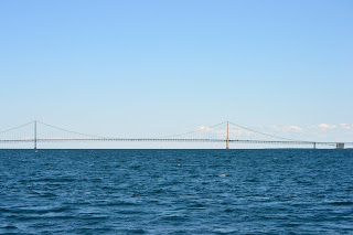
Most people reading this blog are from Texas and Kansas. Don't know about you, but I really had not spent any time in Michigan. If you look at the very northern tip of the main part of the state, there is a bridge. That is the Mackinaw Straits bridge (I-75) that connects the lower main part of Michigan to the Upper Pennisula (UP). The bridge looks much like the Golden Gate. Its big. Mackinac Island sits two miles to the east of this bridge and is in Lake Huron. West of the bridge starts Lake Michigan. It is the border between the two great lakes. Mackinac Island is like Branson on the Great Lakes. Lots of tourists, ice cream and fudge shops, and restaurants focused on the tourists. It is pretty though.
I think of dumb stuff as I travel through these waters. Such as, who drew these state and national lines? Why did Michigan get the UP? Its this big long piece of land between Lake Michigan and Lake Superior that runs east and west. Why wasn't that part of Wisconsin. Those Wisconsin guys were poor negotiators I think. Who put the US-Canada border around Drummond Island (US) and Cockburn Island (Canada).
From the water they look identical and seem like nice neighbors. Who sat around the table with a big map and their pencils......
Oh well, the stock market is down, its a record setting hot summer, there are about 10 people running for President, and the world goes on. But I really would like to know who were those guys? Marc
No comments:
Post a Comment